Tennessee Landforms -- waterfalls| WGS84 |
| 36.474000 | -84.650000 |
| 36° 28.44'N | 84° 39'W |
| 36° 28' 26.4"N | 84° 39' 0"W |
| 16S 710543E 4039092N |
| convert to NAD27 |
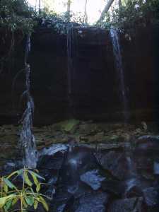
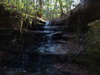
Copperhead Falls 18'
Waypoint: SCF015 36.474000,-84.650000
County: Scott landforms of Scott county
Locale: Big South Fork
popup list of
nearby landforms (mileage, bearing)
MAPS
Select one of the following maps to display this waypoint (WGS84).
GPS
Remarks:
Wet-weather falls, off-trail, with several smaller feeder falls upstream.
Nearby is a natural bridge with a small
creek passing through it then over the bluff.
Tennessee landforms
home
arches
waterfalls
rocks
peaks
balds
sinks
lakes
regions
county
GSMNP landforms (TN/NC)
BSF landforms (TN/KY)
or nearby
lookout towers
Chuck Sutherland's www.tnlandforms.com the future (2024)
 ©
Tom Dunigan
©
Tom Dunigan