Tennessee Landforms -- waterfalls| WGS84 |
| 36.427655 | -84.653915 |
| 36° 25.659'N | 84° 39.235'W |
| 36° 25' 39.5"N | 84° 39' 14.1"W |
| 16S 710317E 4033941N |
| convert to NAD27 |
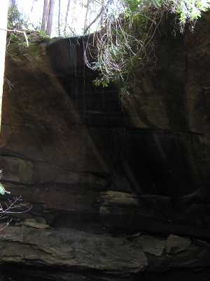
Ice Castle Falls 40'
Waypoint: SCF008 36.427655,-84.653915
County: Scott landforms of Scott county
Locale: Big South Fork
popup list of
nearby landforms (mileage, bearing)
MAPS
Select one of the following maps to display this waypoint (WGS84).
GPS
Remarks:
Honey Creek trail, wet-weather falls
Tennessee landforms
home
arches
waterfalls
rocks
peaks
balds
sinks
lakes
regions
county
GSMNP landforms (TN/NC)
BSF landforms (TN/KY)
or nearby
lookout towers
Chuck Sutherland's www.tnlandforms.com the future (2024)
 ©
Tom Dunigan
©
Tom Dunigan