Tennessee Landforms -- waterfalls| WGS84 |
| 36.407140 | -84.625800 |
| 36° 24.428'N | 84° 37.548'W |
| 36° 24' 25.7"N | 84° 37' 32.9"W |
| 16S 712894E 4031727N |
| convert to NAD27 |
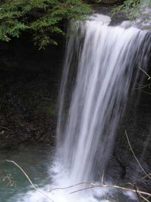
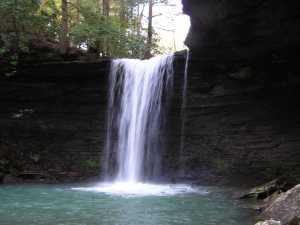
Beaver Falls 20'
Waypoint: SCF002 36.407140,-84.625800
County: Scott landforms of Scott county
Locale: Big South Fork
popup list of
nearby landforms (mileage, bearing)
MAPS
Select one of the following maps to display this waypoint (WGS84).
GPS
Remarks:
off-trail from John Muir trail,
see narrative
Tennessee landforms
home
arches
waterfalls
rocks
peaks
balds
sinks
lakes
regions
county
GSMNP landforms (TN/NC)
BSF landforms (TN/KY)
or nearby
lookout towers
Chuck Sutherland's www.tnlandforms.com the future (2024)
 ©
Tom Dunigan
©
Tom Dunigan