| WGS84 | |
| 36.577633 | -84.692850 |
| 36° 34.658'N | 84° 41.571'W |
| 36° 34' 39.5"N | 84° 41' 34.3"W |
| 16S 706427E 4050497N | |
| convert to NAD27 | |
MAPS
Select one of the following maps to display this waypoint (WGS84).
GPS
Remarks:
Reference and photo: Duane Ridenour
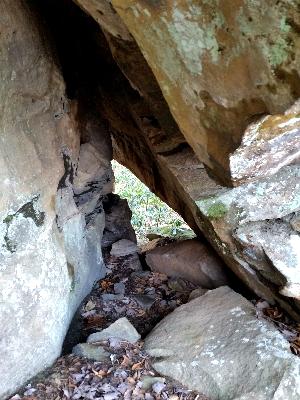
a tunnel (or tunnel arch) with a gravity arch on top of
it. It makes a nice little shortcut through the bluffline and from it's
eastern exit, you can see all the way down Anderson Cave Branch drainage to
the bluffs across No Business Creek this time of year. It is only 2' wide,
and 10' tall but it is over 20' long