Tennessee Landforms -- arches and natural bridges| WGS84 |
| 36.487440 | -84.704440 |
| 36° 29.246'N | 84° 42.266'W |
| 36° 29' 14.8"N | 84° 42' 16"W |
| 16S 705629E 4040465N |
| convert to NAD27 |
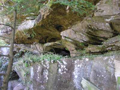
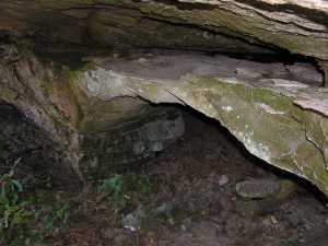
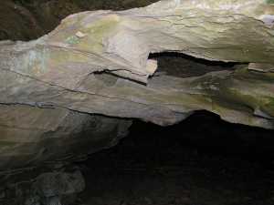
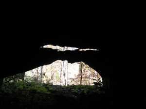
Muleshoe Hollow Arch 9x4
Waypoint: SCA053 36.487440,-84.704440
County: Scott landforms of Scott county
Locale: Big South Fork
NABSQNO 16S-705629-4040465
popup list of
nearby landforms (mileage, bearing)
MAPS
Select one of the following maps to display this waypoint (WGS84).
GPS
Remarks:
Reference: Keith Garnes
off-trail and a double arch with thin lintel across main opening.
The lintel also has a hole.
Tennessee landforms
home
arches
waterfalls
rocks
peaks
balds
sinks
lakes
regions
county
GSMNP landforms (TN/NC)
BSF landforms (TN/KY)
or nearby
lookout towers
Chuck Sutherland's www.tnlandforms.com the future (2024)
 ©
Tom Dunigan
©
Tom Dunigan