Tennessee Landforms -- arches and natural bridges| WGS84 |
| 36.385100 | -84.648600 |
| 36° 23.106'N | 84° 38.916'W |
| 36° 23' 6.4"N | 84° 38' 55"W |
| 16S 710909E 4029231N |
| convert to NAD27 |
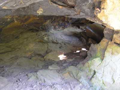
Burnt Mill Column 4x2
Waypoint: SCA044 36.385100,-84.648600
County: Scott landforms of Scott county
Locale: Big South Fork
NABSQNO 16S-710909-4029231
popup list of
nearby landforms (mileage, bearing)
MAPS
Select one of the following maps to display this waypoint (WGS84).
GPS
Remarks:
small column arch along Burnt Mill Loop trail
Tennessee landforms
home
arches
waterfalls
rocks
peaks
balds
sinks
lakes
regions
county
GSMNP landforms (TN/NC)
BSF landforms (TN/KY)
or nearby
lookout towers
Chuck Sutherland's www.tnlandforms.com the future (2024)
 ©
Tom Dunigan
©
Tom Dunigan