Tennessee Landforms -- arches and natural bridges| WGS84 |
| 36.517000 | -84.723639 |
| 36° 31.02'N | 84° 43.418'W |
| 36° 31' 1.2"N | 84° 43' 25.1"W |
| 16S 703831E 4043704N |
| convert to NAD27 |
Tubeway Triple 11x4
Waypoint: SCA040 36.517000,-84.723639
County: Scott landforms of Scott county
Locale: Big South Fork
NABSQNO 16S-703831-4043704
popup list of
nearby landforms (mileage, bearing)
MAPS
Select one of the following maps to display this waypoint (WGS84).
GPS
Remarks:
Reference: team Fife
off-trail tunnel crawl leads to double arch
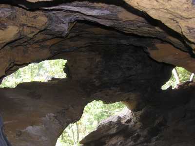

another small arch 15 minutes further along the bluff line (Fife).
Tennessee landforms
home
arches
waterfalls
rocks
peaks
balds
sinks
lakes
regions
county
GSMNP landforms (TN/NC)
BSF landforms (TN/KY)
or nearby
lookout towers
Chuck Sutherland's www.tnlandforms.com the future (2024)
 ©
Tom Dunigan
©
Tom Dunigan