Tennessee Landforms -- arches and natural bridges| WGS84 |
| 36.469600 | -84.659000 |
| 36° 28.176'N | 84° 39.54'W |
| 36° 28' 10.6"N | 84° 39' 32.4"W |
| 16S 709748E 4038584N |
| convert to NAD27 |
Devil's Cave 35x60
Waypoint: SCA036 36.469600,-84.659000
County: Scott landforms of Scott county
Locale: Big South Fork
NABSQNO 16S-709748-4038584
popup list of
nearby landforms (mileage, bearing)
MAPS
Select one of the following maps to display this waypoint (WGS84).
GPS
Remarks:
manway to this cleft in the caprock. Look into the cave through the skylights
up top, or scramble down to the base.
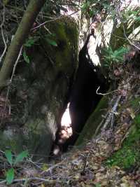
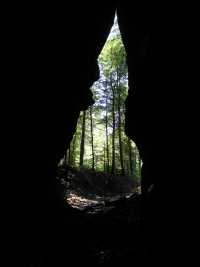
Chuck Sutherland's stunning photo
Tennessee landforms
home
arches
waterfalls
rocks
peaks
balds
sinks
lakes
regions
county
GSMNP landforms (TN/NC)
BSF landforms (TN/KY)
or nearby
lookout towers
Chuck Sutherland's www.tnlandforms.com the future (2024)
 ©
Tom Dunigan
©
Tom Dunigan