Tennessee Landforms -- arches and natural bridges| WGS84 |
| 36.452700 | -84.669300 |
| 36° 27.162'N | 84° 40.158'W |
| 36° 27' 9.7"N | 84° 40' 9.5"W |
| 16S 708870E 4036686N |
| convert to NAD27 |
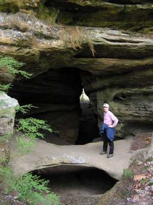
Needles Eye 10x4
Waypoint: SCA026 36.452700,-84.669300
County: Scott landforms of Scott county
Locale: Big South Fork
NABSQNO 16S-708870-4036686
popup list of
nearby landforms (mileage, bearing)
MAPS
Select one of the following maps to display this waypoint (WGS84).
GPS
Remarks:
Reference: Keith Garnes
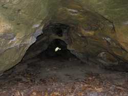
An arch inside a long (150') tunnel.
Also known as Hole in the Ridge.
GPS track
and another
and locale trail map
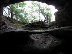

 small tunnel under arch span
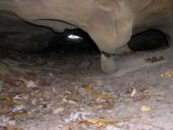
 small tunnel just east along the bluff
Tennessee landforms
home
arches
waterfalls
rocks
peaks
balds
sinks
lakes
regions
county
GSMNP landforms (TN/NC)
BSF landforms (TN/KY)
or nearby
lookout towers
Chuck Sutherland's www.tnlandforms.com the future (2024)
 ©
Tom Dunigan
©
Tom Dunigan