Tennessee Landforms -- arches and natural bridges| WGS84 |
| 36.547700 | -84.659200 |
| 36° 32.862'N | 84° 39.552'W |
| 36° 32' 51.7"N | 84° 39' 33.1"W |
| 16S 709519E 4047249N |
| convert to NAD27 |
Station Camp leaners
Waypoint: SCA025 36.547700,-84.659200
County: Scott landforms of Scott county
Locale: Big South Fork
NABSQNO 16S-709519-4047249
popup list of
nearby landforms (mileage, bearing)
MAPS
Select one of the following maps to display this waypoint (WGS84).
GPS
Remarks:
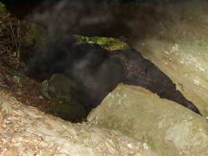
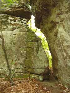
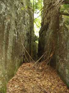
The cap rock has divided into seven or eight large pieces with
narrow passages.
The breakdown in the top of the south watershed has created
several leaner/gravity arches.
Off-trail.
Tennessee landforms
home
arches
waterfalls
rocks
peaks
balds
sinks
lakes
regions
county
GSMNP landforms (TN/NC)
BSF landforms (TN/KY)
or nearby
lookout towers
Chuck Sutherland's www.tnlandforms.com the future (2024)
 ©
Tom Dunigan
©
Tom Dunigan