Tennessee Landforms -- arches and natural bridges| WGS84 |
| 36.533200 | -84.726800 |
| 36° 31.992'N | 84° 43.608'W |
| 36° 31' 59.5"N | 84° 43' 36.5"W |
| 16S 703506E 4045495N |
| convert to NAD27 |
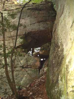
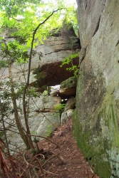
Bob's Arch 12x10
Waypoint: SCA017 36.533200,-84.726800
County: Scott landforms of Scott county
Locale: Big South Fork
NABSQNO 16S-703506-4045495
popup list of
nearby landforms (mileage, bearing)
MAPS
Select one of the following maps to display this waypoint (WGS84).
GPS
Remarks:
Reference: team Fife
view from west. off-trail -- 2nd photo courtesy of Brad Neff.
Tennessee landforms
home
arches
waterfalls
rocks
peaks
balds
sinks
lakes
regions
county
GSMNP landforms (TN/NC)
BSF landforms (TN/KY)
or nearby
lookout towers
Chuck Sutherland's www.tnlandforms.com the future (2024)
 ©
Tom Dunigan
©
Tom Dunigan