Tennessee Landforms -- arches and natural bridges| WGS84 |
| 36.581200 | -84.673100 |
| 36° 34.872'N | 84° 40.386'W |
| 36° 34' 52.3"N | 84° 40' 23.2"W |
| 16S 708185E 4050935N |
| convert to NAD27 |
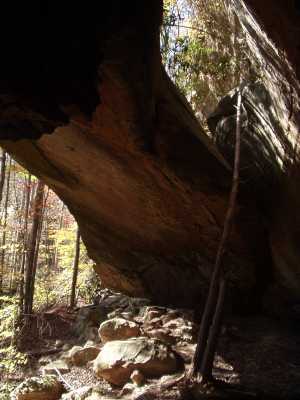
Russell Arch 100x30
Waypoint: SCA010 36.581200,-84.673100
County: Scott landforms of Scott county
Locale: Big South Fork
NABSQNO 16S-708185-4050935
popup list of
nearby landforms (mileage, bearing)
MAPS
Select one of the following maps to display this waypoint (WGS84).
GPS
Remarks:
References: JNAD:TENN-9, WAD:44.12
Also known as Morning Arch. Off-trail. Other arches east and south
along same wall.
Tennessee landforms
home
arches
waterfalls
rocks
peaks
balds
sinks
lakes
regions
county
GSMNP landforms (TN/NC)
BSF landforms (TN/KY)
or nearby
lookout towers
Chuck Sutherland's www.tnlandforms.com the future (2024)
 ©
Tom Dunigan
©
Tom Dunigan