Tennessee Landforms -- waterfalls| WGS84 |
| 35.926780 | -84.551060 |
| 35° 55.607'N | 84° 33.064'W |
| 35° 55' 36.4"N | 84° 33' 3.8"W |
| 16S 720942E 3978599N |
| convert to NAD27 |
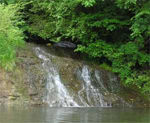
Harriman Cascade 18'
Waypoint: ROF001 35.926780,-84.551060
County: Roane landforms of Roane county
popup list of
nearby landforms (mileage, bearing)
MAPS
Select one of the following maps to display this waypoint (WGS84).
GPS
Remarks:
Best viewed from the water.
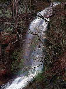 Chris Oliver photo of falls 250' east (Tubb Springs)
Tennessee landforms
home
arches
waterfalls
rocks
peaks
balds
sinks
lakes
regions
county
GSMNP landforms (TN/NC)
BSF landforms (TN/KY)
or nearby
lookout towers
Chuck Sutherland's www.tnlandforms.com the future (2024)
 ©
Tom Dunigan
©
Tom Dunigan