Tennessee Landforms -- arches and natural bridges| WGS84 |
| 35.939333 | -84.562494 |
| 35° 56.36'N | 84° 33.75'W |
| 35° 56' 21.6"N | 84° 33' 45"W |
| 16S 719876E 3979966N |
| convert to NAD27 |
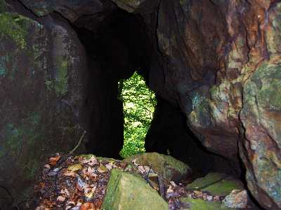
Emory Gap Arch 2x5
Waypoint: ROA006 35.939333,-84.562494
County: Roane landforms of Roane county
NABSQNO 16S-719876-3979966
popup list of
nearby landforms (mileage, bearing)
MAPS
Select one of the following maps to display this waypoint (WGS84).
GPS
Remarks:
Reference and photo: Chris Oliver
Tennessee landforms
home
arches
waterfalls
rocks
peaks
balds
sinks
lakes
regions
county
GSMNP landforms (TN/NC)
BSF landforms (TN/KY)
or nearby
lookout towers
Chuck Sutherland's www.tnlandforms.com the future (2024)
 ©
Tom Dunigan
©
Tom Dunigan