Tennessee Landforms -- arches and natural bridges| WGS84 |
| 35.860600 | -84.369700 |
| 35° 51.636'N | 84° 22.182'W |
| 35° 51' 38.2"N | 84° 22' 10.9"W |
| 16S 737506E 3971682N |
| convert to NAD27 |
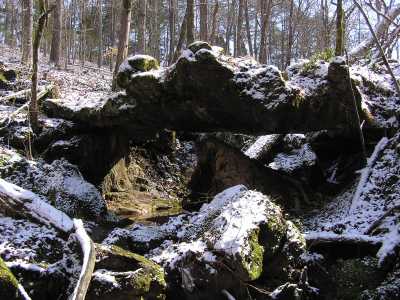
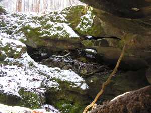
Tate's Natural Bridge 17x7
Waypoint: ROA004 35.860600,-84.369700
County: Roane landforms of Roane county
Locale: private
NABSQNO 16S-737506-3971682
popup list of
nearby landforms (mileage, bearing)
MAPS
Select one of the following maps to display this waypoint (WGS84).
GPS
Remarks:
Reference: Robert Robbins
2 part natural bridge, downstream a bit
is Tate's Arch
Tennessee landforms
home
arches
waterfalls
rocks
peaks
balds
sinks
lakes
regions
county
GSMNP landforms (TN/NC)
BSF landforms (TN/KY)
or nearby
lookout towers
Chuck Sutherland's www.tnlandforms.com the future (2024)
 ©
Tom Dunigan
©
Tom Dunigan