Tennessee Landforms -- waterfalls| WGS84 |
| 35.685313 | -84.911155 |
| 35° 41.119'N | 84° 54.669'W |
| 35° 41' 7.1"N | 84° 54' 40.1"W |
| 16S 689021E 3951056N |
| convert to NAD27 |
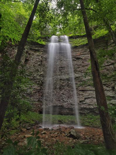
PaPaw Falls 82'
Waypoint: RHF035 35.685313,-84.911155
County: Rhea landforms of Rhea county
Locale: CT
popup list of
nearby landforms (mileage, bearing)
MAPS
Select one of the following maps to display this waypoint (WGS84).
GPS
Remarks:
Reference: Brian Solomon and his photo
 seasonal
Tennessee landforms
home
arches
waterfalls
rocks
peaks
balds
sinks
lakes
regions
county
GSMNP landforms (TN/NC)
BSF landforms (TN/KY)
or nearby
lookout towers
Chuck Sutherland's www.tnlandforms.com the future (2024)
 ©
Tom Dunigan
©
Tom Dunigan