Tennessee Landforms -- waterfalls| WGS84 |
| 35.495101 | -85.087582 |
| 35° 29.706'N | 85° 5.255'W |
| 35° 29' 42.4"N | 85° 5' 15.3"W |
| 16S 673464E 3929631N |
| convert to NAD27 |
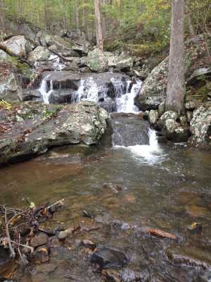
Gilbreath Cascades
Waypoint: RHF023 35.495101,-85.087582
County: Rhea landforms of Rhea county
Locale: CT
popup list of
nearby landforms (mileage, bearing)
MAPS
Select one of the following maps to display this waypoint (WGS84).
GPS
Remarks:
A series of cascades, probably way down stream is a falls.
Tennessee landforms
home
arches
waterfalls
rocks
peaks
balds
sinks
lakes
regions
county
GSMNP landforms (TN/NC)
BSF landforms (TN/KY)
or nearby
lookout towers
Chuck Sutherland's www.tnlandforms.com the future (2024)
 ©
Tom Dunigan
©
Tom Dunigan