Tennessee Landforms -- waterfalls| WGS84 |
| 35.721110 | -84.927090 |
| 35° 43.267'N | 84° 55.625'W |
| 35° 43' 16"N | 84° 55' 37.5"W |
| 16S 687495E 3954997N |
| convert to NAD27 |
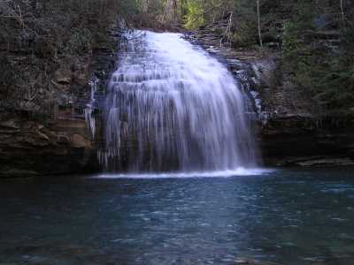
Stinging Fork Falls 60'
Waypoint: RHF009 35.721110,-84.927090
County: Rhea landforms of Rhea county
Locale: Cumberland Trail
popup list of
nearby landforms (mileage, bearing)
MAPS
Select one of the following maps to display this waypoint (WGS84).
GPS
Remarks:
State
natural area
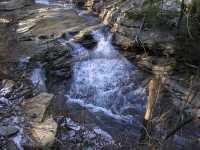 upper falls
Tennessee landforms
home
arches
waterfalls
rocks
peaks
balds
sinks
lakes
regions
county
GSMNP landforms (TN/NC)
BSF landforms (TN/KY)
or nearby
lookout towers
Chuck Sutherland's www.tnlandforms.com the future (2024)
 ©
Tom Dunigan
©
Tom Dunigan