Tennessee Landforms -- waterfalls| WGS84 |
| 35.528100 | -85.021200 |
| 35° 31.686'N | 85° 1.272'W |
| 35° 31' 41.2"N | 85° 1' 16.3"W |
| 16S 679413E 3933411N |
| convert to NAD27 |
Paine Creek Falls(2) 10'
Waypoint: RHF006 35.528100,-85.021200
County: Rhea landforms of Rhea county
Locale: Cumberland Trail
popup list of
nearby landforms (mileage, bearing)
MAPS
Select one of the following maps to display this waypoint (WGS84).
GPS
Remarks:
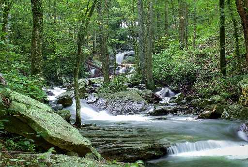 Chris Oliver photo
Chuck Sutherland
photo of 20' upper falls at
35.52894,-85.019817
Tennessee landforms
home
arches
waterfalls
rocks
peaks
balds
sinks
lakes
regions
county
GSMNP landforms (TN/NC)
BSF landforms (TN/KY)
or nearby
lookout towers
Chuck Sutherland's www.tnlandforms.com the future (2024)
 ©
Tom Dunigan
©
Tom Dunigan