Tennessee Landforms -- waterfalls| WGS84 |
| 35.728610 | -84.865280 |
| 35° 43.717'N | 84° 51.917'W |
| 35° 43' 43"N | 84° 51' 55"W |
| 16S 693069E 3955949N |
| convert to NAD27 |
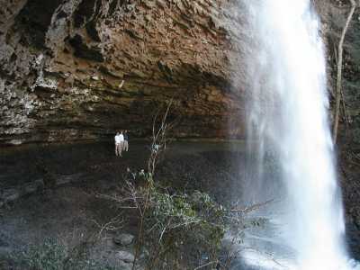
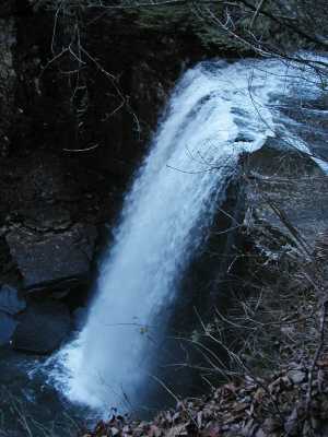
Lower Piney Falls 40'
Waypoint: RHF005 35.728610,-84.865280
County: Rhea landforms of Rhea county
Locale: TNNA
popup list of
nearby landforms (mileage, bearing)
MAPS
Select one of the following maps to display this waypoint (WGS84).
GPS
Remarks:
An article on
Upper and lower Piney Falls
Upper and Lower falls
Tennessee landforms
home
arches
waterfalls
rocks
peaks
balds
sinks
lakes
regions
county
GSMNP landforms (TN/NC)
BSF landforms (TN/KY)
or nearby
lookout towers
Chuck Sutherland's www.tnlandforms.com the future (2024)
 ©
Tom Dunigan
©
Tom Dunigan