Tennessee Landforms -- waterfalls| WGS84 |
| 35.692600 | -84.922450 |
| 35° 41.556'N | 84° 55.347'W |
| 35° 41' 33.4"N | 84° 55' 20.8"W |
| 16S 687982E 3951843N |
| convert to NAD27 |
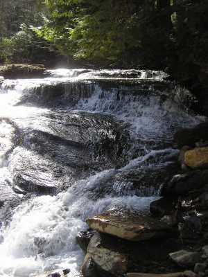
Deep Pool Cascades 8'
Waypoint: RHF003 35.692600,-84.922450
County: Rhea landforms of Rhea county
Locale: Cumberland Trail
popup list of
nearby landforms (mileage, bearing)
MAPS
Select one of the following maps to display this waypoint (WGS84).
GPS
Remarks:
along
Piney River Trail
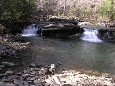
 another cascade further upstream
Tennessee landforms
home
arches
waterfalls
rocks
peaks
balds
sinks
lakes
regions
county
GSMNP landforms (TN/NC)
BSF landforms (TN/KY)
or nearby
lookout towers
Chuck Sutherland's www.tnlandforms.com the future (2024)
 ©
Tom Dunigan
©
Tom Dunigan