Tennessee Landforms -- waterfalls| WGS84 |
| 36.120640 | -85.269966 |
| 36° 7.238'N | 85° 16.198'W |
| 36° 7' 14.3"N | 85° 16' 11.9"W |
| 16S 655693E 3998715N |
| convert to NAD27 |
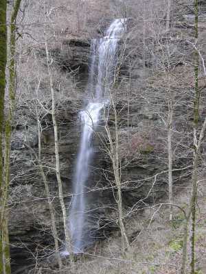
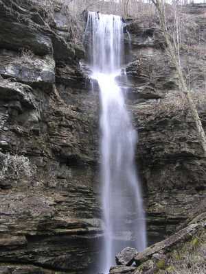
Verble Hollow Falls 100'
Waypoint: PUF012 36.120640,-85.269966
County: Putnam landforms of Putnam county
Locale: private
popup list of
nearby landforms (mileage, bearing)
MAPS
Select one of the following maps to display this waypoint (WGS84).
GPS
Remarks:
Out of a cave, 100' drop into sinkhole.
Tennessee landforms
home
arches
waterfalls
rocks
peaks
balds
sinks
lakes
regions
county
GSMNP landforms (TN/NC)
BSF landforms (TN/KY)
or nearby
lookout towers
Chuck Sutherland's www.tnlandforms.com the future (2024)
 ©
Tom Dunigan
©
Tom Dunigan