Tennessee Landforms -- waterfalls| WGS84 |
| 36.062937 | -85.604326 |
| 36° 3.776'N | 85° 36.26'W |
| 36° 3' 46.6"N | 85° 36' 15.6"W |
| 16S 625693E 3991830N |
| convert to NAD27 |
Oxbow Falls 11'
Waypoint: PUF011 36.062937,-85.604326
County: Putnam landforms of Putnam county
Locale: private
popup list of
nearby landforms (mileage, bearing)
MAPS
Select one of the following maps to display this waypoint (WGS84).
GPS
Remarks:
Reference and photo: Michael West
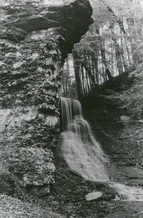 wet-weather falls near Window Cliffs
Tennessee landforms
home
arches
waterfalls
rocks
peaks
balds
sinks
lakes
regions
county
GSMNP landforms (TN/NC)
BSF landforms (TN/KY)
or nearby
lookout towers
Chuck Sutherland's www.tnlandforms.com the future (2024)
 ©
Tom Dunigan
©
Tom Dunigan