Tennessee Landforms -- waterfalls| WGS84 |
| 36.302502 | -85.475844 |
| 36° 18.15'N | 85° 28.551'W |
| 36° 18' 9"N | 85° 28' 33.1"W |
| 16S 636847E 4018579N |
| convert to NAD27 |
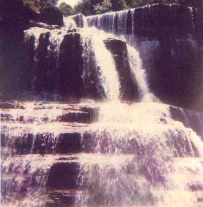
Mill Creek Falls 50'
Waypoint: PUF007 36.302502,-85.475844
County: Putnam landforms of Putnam county
Locale: TSR
popup list of
nearby landforms (mileage, bearing)
MAPS
Select one of the following maps to display this waypoint (WGS84).
GPS
Remarks:
whitewater info Spring Creek
photo courtesy of Vic Fife
Chuck Sutherland photo and he notes a 15' upper falls at
36.29769, -85.478814 and his
HDR photo
Tennessee landforms
home
arches
waterfalls
rocks
peaks
balds
sinks
lakes
regions
county
GSMNP landforms (TN/NC)
BSF landforms (TN/KY)
or nearby
lookout towers
Chuck Sutherland's www.tnlandforms.com the future (2024)
 ©
Tom Dunigan
©
Tom Dunigan