Tennessee Landforms -- waterfalls| WGS84 |
| 36.044505 | -85.595464 |
| 36° 2.67'N | 85° 35.728'W |
| 36° 2' 40.2"N | 85° 35' 43.7"W |
| 16S 626520E 3989797N |
| convert to NAD27 |
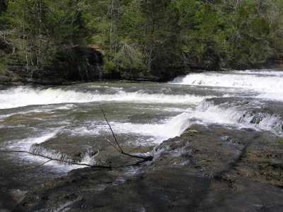
Falling Water Cascades 10'
Waypoint: PUF003 36.044505,-85.595464
County: Putnam landforms of Putnam county
Locale: state park
popup list of
nearby landforms (mileage, bearing)
MAPS
Select one of the following maps to display this waypoint (WGS84).
GPS
Remarks:
The prelude to the three Burgess Falls
Tennessee landforms
home
arches
waterfalls
rocks
peaks
balds
sinks
lakes
regions
county
GSMNP landforms (TN/NC)
BSF landforms (TN/KY)
or nearby
lookout towers
Chuck Sutherland's www.tnlandforms.com the future (2024)
 ©
Tom Dunigan
©
Tom Dunigan