Tennessee Landforms -- arches and natural bridges| WGS84 |
| 36.078850 | -85.333640 |
| 36° 4.731'N | 85° 20.018'W |
| 36° 4' 43.9"N | 85° 20' 1.1"W |
| 16S 650042E 3993979N |
| convert to NAD27 |
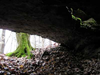
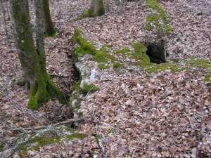
Calfkiller Natural Bridge 12x3
Waypoint: PUA006 36.078850,-85.333640
County: Putnam landforms of Putnam county
Locale: private
NABSQNO 16S-650042-3993979
popup list of
nearby landforms (mileage, bearing)
MAPS
Select one of the following maps to display this waypoint (WGS84).
GPS
Remarks:
Reference: Vic Fife
12' span over sinkhole
Tennessee landforms
home
arches
waterfalls
rocks
peaks
balds
sinks
lakes
regions
county
GSMNP landforms (TN/NC)
BSF landforms (TN/KY)
or nearby
lookout towers
Chuck Sutherland's www.tnlandforms.com the future (2024)
 ©
Tom Dunigan
©
Tom Dunigan