Tennessee Landforms -- arches and natural bridges| WGS84 |
| 36.033110 | -85.266760 |
| 36° 1.987'N | 85° 16.006'W |
| 36° 1' 59.2"N | 85° 16' 0.4"W |
| 16S 656155E 3989010N |
| convert to NAD27 |
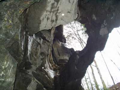
England Cove Arch 12x20
Waypoint: PUA005 36.033110,-85.266760
County: Putnam landforms of Putnam county
NABSQNO 16S-656155-3989010
popup list of
nearby landforms (mileage, bearing)
MAPS
Select one of the following maps to display this waypoint (WGS84).
GPS
Remarks:
Tennessee landforms
home
arches
waterfalls
rocks
peaks
balds
sinks
lakes
regions
county
GSMNP landforms (TN/NC)
BSF landforms (TN/KY)
or nearby
lookout towers
Chuck Sutherland's www.tnlandforms.com the future (2024)
 ©
Tom Dunigan
©
Tom Dunigan