Tennessee Landforms -- arches and natural bridges| WGS84 |
| 36.140220 | -85.285200 |
| 36° 8.413'N | 85° 17.112'W |
| 36° 8' 24.8"N | 85° 17' 6.7"W |
| 16S 654284E 4000863N |
| convert to NAD27 |
Monterey Window 3x3
Waypoint: PUA003 36.140220,-85.285200
County: Putnam landforms of Putnam county
NABSQNO 16S-654284-4000863
popup list of
nearby landforms (mileage, bearing)
MAPS
Select one of the following maps to display this waypoint (WGS84).
GPS
Remarks:
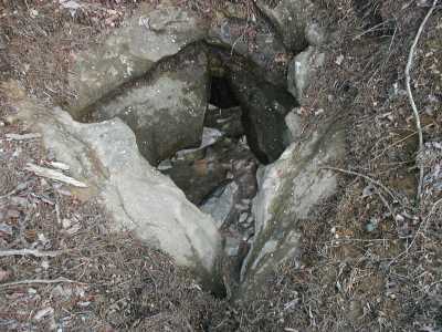
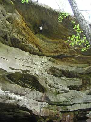
A skylight in the rockhouse, bout a hundred foot drop thru the hole.
Nearby is Cracked Bluff arch.
Tennessee landforms
home
arches
waterfalls
rocks
peaks
balds
sinks
lakes
regions
county
GSMNP landforms (TN/NC)
BSF landforms (TN/KY)
or nearby
lookout towers
Chuck Sutherland's www.tnlandforms.com the future (2024)
 ©
Tom Dunigan
©
Tom Dunigan