Tennessee Landforms -- waterfalls| WGS84 |
| 35.130550 | -84.593190 |
| 35° 7.833'N | 84° 35.591'W |
| 35° 7' 50"N | 84° 35' 35.5"W |
| 16S 719298E 3890172N |
| convert to NAD27 |
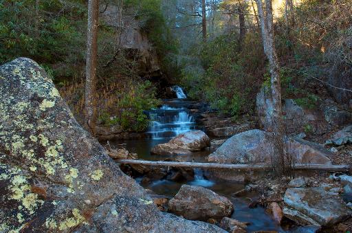
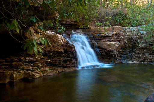
Right Angle Falls 9'
Waypoint: POF024 35.130550,-84.593190
County: Polk landforms of Polk county
Locale: Cherokee National Forest
popup list of
nearby landforms (mileage, bearing)
MAPS
Select one of the following maps to display this waypoint (WGS84).
GPS
Remarks:
Reference and photos: Michael Shannon
old Dutch Roth
photo and
thumbnails
Tennessee landforms
home
arches
waterfalls
rocks
peaks
balds
sinks
lakes
regions
county
GSMNP landforms (TN/NC)
BSF landforms (TN/KY)
or nearby
lookout towers
Chuck Sutherland's www.tnlandforms.com the future (2024)
 ©
Tom Dunigan
©
Tom Dunigan