Tennessee Landforms -- waterfalls| WGS84 |
| 35.197621 | -84.511368 |
| 35° 11.857'N | 84° 30.682'W |
| 35° 11' 51.4"N | 84° 30' 40.9"W |
| 16S 726569E 3897796N |
| convert to NAD27 |
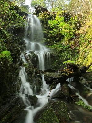
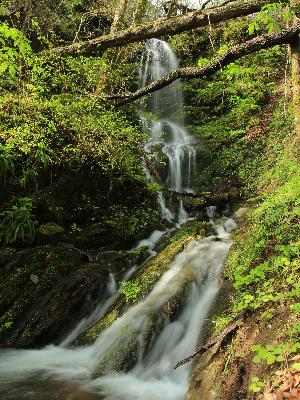
Spring Falls Br 40'
Waypoint: POF023 35.197621,-84.511368
County: Polk landforms of Polk county
Locale: Cherokee National Forest
popup list of
nearby landforms (mileage, bearing)
MAPS
Select one of the following maps to display this waypoint (WGS84).
GPS
Remarks:
Reference and photos: Brian Solomon
Tennessee landforms
home
arches
waterfalls
rocks
peaks
balds
sinks
lakes
regions
county
GSMNP landforms (TN/NC)
BSF landforms (TN/KY)
or nearby
lookout towers
Chuck Sutherland's www.tnlandforms.com the future (2024)
 ©
Tom Dunigan
©
Tom Dunigan