Tennessee Landforms -- waterfalls| WGS84 |
| 35.139940 | -84.596940 |
| 35° 8.396'N | 84° 35.816'W |
| 35° 8' 23.8"N | 84° 35' 49"W |
| 16S 718931E 3891206N |
| convert to NAD27 |
Elora Falls 20'
Waypoint: POF021 35.139940,-84.596940
County: Polk landforms of Polk county
Locale: Cherokee National Forest
popup list of
nearby landforms (mileage, bearing)
MAPS
Select one of the following maps to display this waypoint (WGS84).
GPS
Remarks:
Reference and photo: Brian Solomon
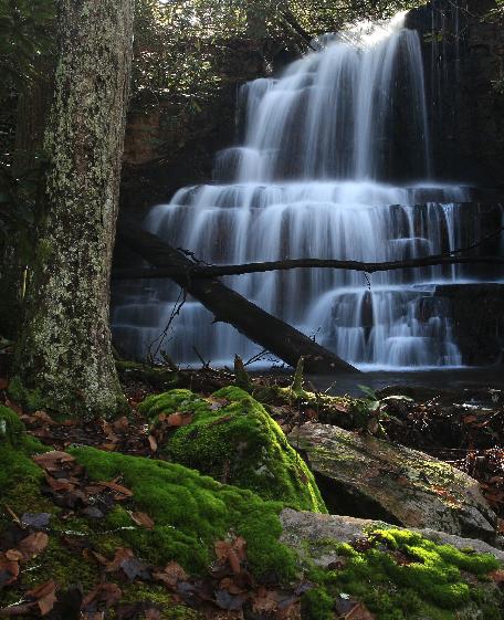 Elora Falls
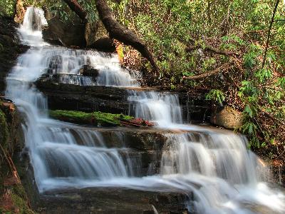
another 35' falls
downstream at
35.140083,-84.596628
Tennessee landforms
home
arches
waterfalls
rocks
peaks
balds
sinks
lakes
regions
county
GSMNP landforms (TN/NC)
BSF landforms (TN/KY)
or nearby
lookout towers
Chuck Sutherland's www.tnlandforms.com the future (2024)
 ©
Tom Dunigan
©
Tom Dunigan