Tennessee Landforms -- waterfalls| WGS84 |
| 35.220700 | -84.533400 |
| 35° 13.242'N | 84° 32.004'W |
| 35° 13' 14.5"N | 84° 32' 0.2"W |
| 16S 724499E 3900306N |
| convert to NAD27 |
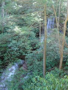
Left Prong Falls 30'
Waypoint: POF017 35.220700,-84.533400
County: Polk landforms of Polk county
Locale: Cherokee National Forest
popup list of
nearby landforms (mileage, bearing)
MAPS
Select one of the following maps to display this waypoint (WGS84).
GPS
Remarks:
East of Lowry Falls but off-trail.
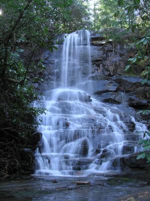
 from a distance, falls and lower cascade
Tennessee landforms
home
arches
waterfalls
rocks
peaks
balds
sinks
lakes
regions
county
GSMNP landforms (TN/NC)
BSF landforms (TN/KY)
or nearby
lookout towers
Chuck Sutherland's www.tnlandforms.com the future (2024)
 ©
Tom Dunigan
©
Tom Dunigan