Tennessee Landforms -- waterfalls| WGS84 |
| 34.993490 | -84.625020 |
| 34° 59.609'N | 84° 37.501'W |
| 34° 59' 36.5"N | 84° 37' 30.1"W |
| 16S 716759E 3874898N |
| convert to NAD27 |
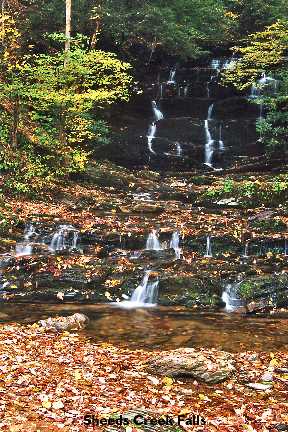
Alaculsy Falls 30'
Waypoint: POF007 34.993490,-84.625020
County: Polk landforms of Polk county
Locale: Cherokee National Forest
popup list of
nearby landforms (mileage, bearing)
MAPS
Select one of the following maps to display this waypoint (WGS84).
GPS
Remarks:
Reference and photo: Robert Schuffert
Tennessee landforms
home
arches
waterfalls
rocks
peaks
balds
sinks
lakes
regions
county
GSMNP landforms (TN/NC)
BSF landforms (TN/KY)
or nearby
lookout towers
Chuck Sutherland's www.tnlandforms.com the future (2024)
 ©
Tom Dunigan
©
Tom Dunigan