Tennessee Landforms -- waterfalls| WGS84 |
| 35.221800 | -84.534700 |
| 35° 13.308'N | 84° 32.082'W |
| 35° 13' 18.5"N | 84° 32' 4.9"W |
| 16S 724377E 3900425N |
| convert to NAD27 |
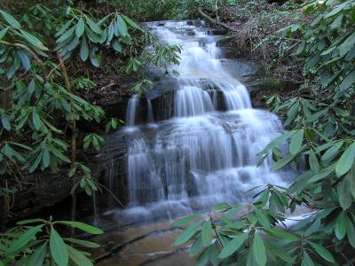
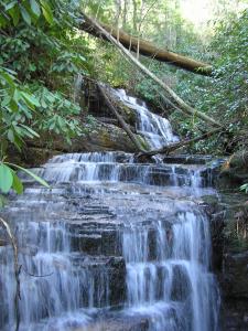
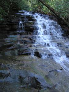
Lowry Falls 10'
Waypoint: POF003 35.221800,-84.534700
County: Polk landforms of Polk county
Locale: Cherokee National Forest
popup list of
nearby landforms (mileage, bearing)
MAPS
Select one of the following maps to display this waypoint (WGS84).
GPS
Remarks:
CNF trail 168, other cascades along the trail, and nearby is
Left Prong Falls
 falls
falls
 cascades
Tennessee landforms
home
arches
waterfalls
rocks
peaks
balds
sinks
lakes
regions
county
GSMNP landforms (TN/NC)
BSF landforms (TN/KY)
or nearby
lookout towers
Chuck Sutherland's www.tnlandforms.com the future (2024)
 ©
Tom Dunigan
©
Tom Dunigan