Tennessee Landforms -- waterfalls| WGS84 |
| 36.573300 | -84.773200 |
| 36° 34.398'N | 84° 46.392'W |
| 36° 34' 23.9"N | 84° 46' 23.5"W |
| 16S 699248E 4049847N |
| convert to NAD27 |
Double Falls 35'
Waypoint: PIF002 36.573300,-84.773200
County: Pickett landforms of Pickett county
Locale: forest
popup list of
nearby landforms (mileage, bearing)
MAPS
Select one of the following maps to display this waypoint (WGS84).
GPS
Remarks:
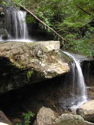
 6' lower falls at confluence
Tennessee landforms
home
arches
waterfalls
rocks
peaks
balds
sinks
lakes
regions
county
GSMNP landforms (TN/NC)
BSF landforms (TN/KY)
or nearby
lookout towers
Chuck Sutherland's www.tnlandforms.com the future (2024)
 ©
Tom Dunigan
©
Tom Dunigan