Tennessee Landforms -- arches and natural bridges| WGS84 |
| 36.547530 | -84.804230 |
| 36° 32.852'N | 84° 48.254'W |
| 36° 32' 51.1"N | 84° 48' 15.2"W |
| 16S 696537E 4046924N |
| convert to NAD27 |
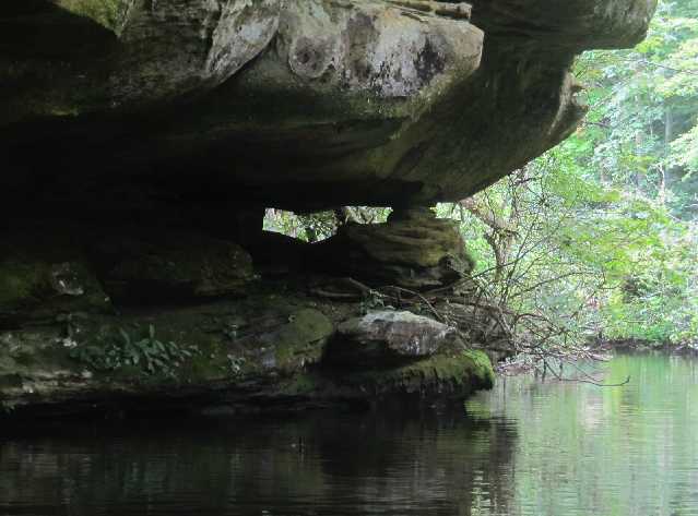
Pickett Lake Arch 4x2
Waypoint: PIA047 36.547530,-84.804230
County: Pickett landforms of Pickett county
Locale: state park
NABSQNO 16S-696537-4046924
popup list of
nearby landforms (mileage, bearing)
MAPS
Select one of the following maps to display this waypoint (WGS84).
GPS
Remarks:
Reference and photo: Keith Garnes
paddle to this small arch
Tennessee landforms
home
arches
waterfalls
rocks
peaks
balds
sinks
lakes
regions
county
GSMNP landforms (TN/NC)
BSF landforms (TN/KY)
or nearby
lookout towers
Chuck Sutherland's www.tnlandforms.com the future (2024)
 ©
Tom Dunigan
©
Tom Dunigan