Tennessee Landforms -- arches and natural bridges| WGS84 |
| 36.541880 | -84.743730 |
| 36° 32.513'N | 84° 44.624'W |
| 36° 32' 30.8"N | 84° 44' 37.4"W |
| 16S 701967E 4046422N |
| convert to NAD27 |
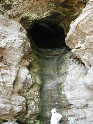
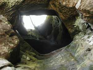
Jakes Chimney 5x25
Waypoint: PIA016 36.541880,-84.743730
County: Pickett landforms of Pickett county
Locale: Big South Fork
NABSQNO 16S-701967-4046422
popup list of
nearby landforms (mileage, bearing)
MAPS
Select one of the following maps to display this waypoint (WGS84).
GPS
Remarks:
References: JNAD:TENN-21, Russ Manning
This vertical tunnel lies about a mile west of the twin arches on
the trail to Jake's Place.
There is also a small arch
south of the trail about 0.8 miles from the
twin arches.
Tennessee landforms
home
arches
waterfalls
rocks
peaks
balds
sinks
lakes
regions
county
GSMNP landforms (TN/NC)
BSF landforms (TN/KY)
or nearby
lookout towers
Chuck Sutherland's www.tnlandforms.com the future (2024)
 ©
Tom Dunigan
©
Tom Dunigan