Tennessee Landforms -- arches and natural bridges| WGS84 |
| 36.557400 | -84.796810 |
| 36° 33.444'N | 84° 47.809'W |
| 36° 33' 26.6"N | 84° 47' 48.5"W |
| 16S 697176E 4048034N |
| convert to NAD27 |
Bluff Tr. Roof Arch 16x2
Waypoint: PIA012 36.557400,-84.796810
County: Pickett landforms of Pickett county
Locale: state park
NABSQNO 16S-697176-4048034
popup list of
nearby landforms (mileage, bearing)
MAPS
Select one of the following maps to display this waypoint (WGS84).
GPS
Remarks:
References: JNAD:TENN-17, Chris Moore
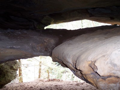 photo courtesy of Keith Garnes
Tennessee landforms
home
arches
waterfalls
rocks
peaks
balds
sinks
lakes
regions
county
GSMNP landforms (TN/NC)
BSF landforms (TN/KY)
or nearby
lookout towers
Chuck Sutherland's www.tnlandforms.com the future (2024)
 ©
Tom Dunigan
©
Tom Dunigan