Tennessee Landforms -- arches and natural bridges| WGS84 |
| 36.544300 | -84.749840 |
| 36° 32.658'N | 84° 44.99'W |
| 36° 32' 39.5"N | 84° 44' 59.4"W |
| 16S 701414E 4046678N |
| convert to NAD27 |
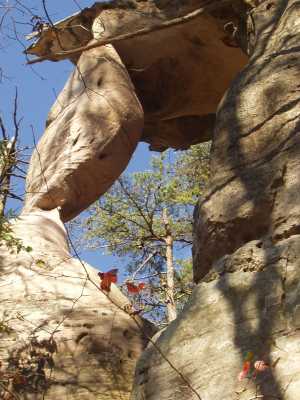
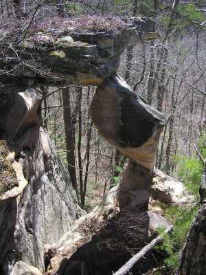
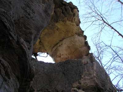
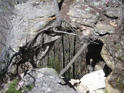
Hanging Rock Arches 10x20
Waypoint: PIA001 36.544300,-84.749840
County: Pickett landforms of Pickett county
Locale: Big South Fork
NABSQNO 16S-701414-4046678
popup list of
nearby landforms (mileage, bearing)
MAPS
Select one of the following maps to display this waypoint (WGS84).
GPS
Remarks:
Reference: team Fife
Two arches off the same point, view from top or bottom.
off-trail
Tennessee landforms
home
arches
waterfalls
rocks
peaks
balds
sinks
lakes
regions
county
GSMNP landforms (TN/NC)
BSF landforms (TN/KY)
or nearby
lookout towers
Chuck Sutherland's www.tnlandforms.com the future (2024)
 ©
Tom Dunigan
©
Tom Dunigan