Tennessee Landforms -- waterfalls| WGS84 |
| 36.342352 | -85.425970 |
| 36° 20.541'N | 85° 25.558'W |
| 36° 20' 32.5"N | 85° 25' 33.5"W |
| 16S 641253E 4023071N |
| convert to NAD27 |
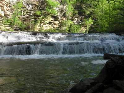
Roaring River Falls 13'
Waypoint: OVF011 36.342352,-85.425970
County: Overton landforms of Overton county
popup list of
nearby landforms (mileage, bearing)
MAPS
Select one of the following maps to display this waypoint (WGS84).
GPS
Remarks:
Also known as Hardy-Reagan Falls or Crawford Mills Falls
Tennessee landforms
home
arches
waterfalls
rocks
peaks
balds
sinks
lakes
regions
county
GSMNP landforms (TN/NC)
BSF landforms (TN/KY)
or nearby
lookout towers
Chuck Sutherland's www.tnlandforms.com the future (2024)
 ©
Tom Dunigan
©
Tom Dunigan