Tennessee Landforms -- waterfalls| WGS84 |
| 36.308500 | -85.162800 |
| 36° 18.51'N | 85° 9.768'W |
| 36° 18' 30.6"N | 85° 9' 46.1"W |
| 16S 664944E 4019733N |
| convert to NAD27 |
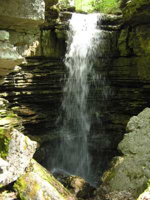
Blue Hole Br Falls 17'
Waypoint: OVF009 36.308500,-85.162800
County: Overton landforms of Overton county
popup list of
nearby landforms (mileage, bearing)
MAPS
Select one of the following maps to display this waypoint (WGS84).
GPS
Remarks:
Reference: Vic Fife
Tennessee landforms
home
arches
waterfalls
rocks
peaks
balds
sinks
lakes
regions
county
GSMNP landforms (TN/NC)
BSF landforms (TN/KY)
or nearby
lookout towers
Chuck Sutherland's www.tnlandforms.com the future (2024)
 ©
Tom Dunigan
©
Tom Dunigan