Tennessee Landforms -- waterfalls| WGS84 |
| 36.310290 | -85.165349 |
| 36° 18.617'N | 85° 9.921'W |
| 36° 18' 37"N | 85° 9' 55.3"W |
| 16S 664711E 4019927N |
| convert to NAD27 |
Rainbow Falls 110'
Waypoint: OVF005 36.310290,-85.165349
County: Overton landforms of Overton county
popup list of
nearby landforms (mileage, bearing)
MAPS
Select one of the following maps to display this waypoint (WGS84).
GPS
Remarks:
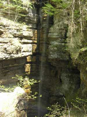
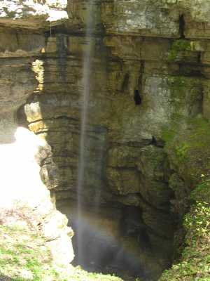 with rainbow at base
Blue Hole Branch and Orange falls nearby
Tennessee landforms
home
arches
waterfalls
rocks
peaks
balds
sinks
lakes
regions
county
GSMNP landforms (TN/NC)
BSF landforms (TN/KY)
or nearby
lookout towers
Chuck Sutherland's www.tnlandforms.com the future (2024)
 ©
Tom Dunigan
©
Tom Dunigan