Tennessee Landforms -- arches and natural bridges| WGS84 |
| 36.208680 | -85.176030 |
| 36° 12.521'N | 85° 10.562'W |
| 36° 12' 31.3"N | 85° 10' 33.7"W |
| 16S 663964E 4008637N |
| convert to NAD27 |
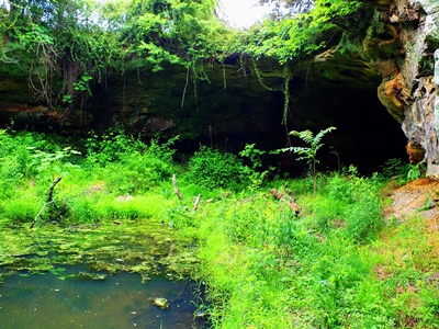
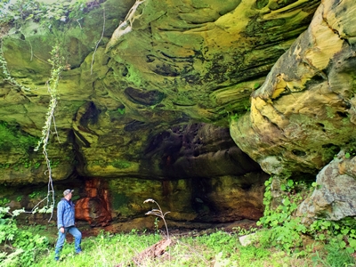
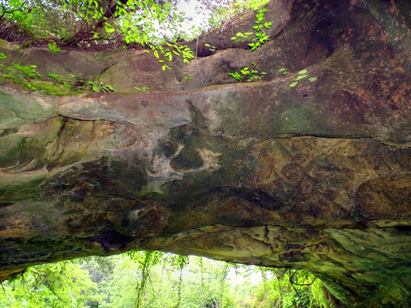
Green Pond Arch
Waypoint: OVA008 36.208680,-85.176030
County: Overton landforms of Overton county
Locale: private
NABSQNO 16S-663964-4008637
popup list of
nearby landforms (mileage, bearing)
MAPS
Select one of the following maps to display this waypoint (WGS84).
GPS
Remarks:
Reference: Fife brothers, photos courtesy Chris Oliver
Tennessee landforms
home
arches
waterfalls
rocks
peaks
balds
sinks
lakes
regions
county
GSMNP landforms (TN/NC)
BSF landforms (TN/KY)
or nearby
lookout towers
Chuck Sutherland's www.tnlandforms.com the future (2024)
 ©
Tom Dunigan
©
Tom Dunigan