Tennessee Landforms -- waterfalls| WGS84 |
| 35.393030 | -84.076130 |
| 35° 23.582'N | 84° 4.568'W |
| 35° 23' 34.9"N | 84° 4' 34.1"W |
| 16S 765564E 3920557N |
| convert to NAD27 |
Ike Camp Br Falls
Waypoint: MOF053 35.393030,-84.076130
County: Monroe landforms of Monroe county
Locale: Cherokee National Forest
popup list of
nearby landforms (mileage, bearing)
MAPS
Select one of the following maps to display this waypoint (WGS84).
GPS
Remarks:
Reference and photo: Gretchen Kirkland

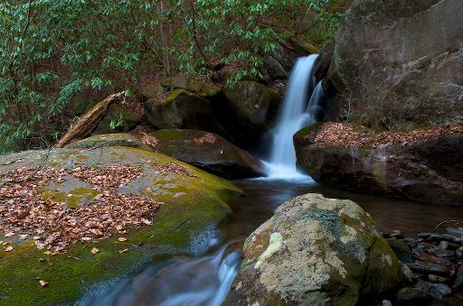 Michael Shannon photo
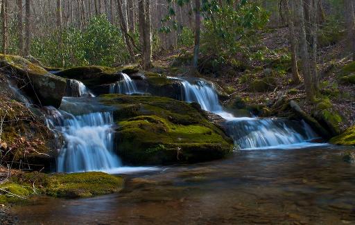 8' falls at 35.38953,-84.07283
Tennessee landforms
home
arches
waterfalls
rocks
peaks
balds
sinks
lakes
regions
county
GSMNP landforms (TN/NC)
BSF landforms (TN/KY)
or nearby
lookout towers
Chuck Sutherland's www.tnlandforms.com the future (2024)
 ©
Tom Dunigan
©
Tom Dunigan