 Upper falls 30'
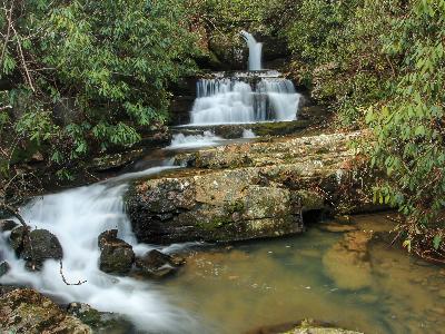
 Middle falls 20'
at
35.28029,-84.46563
Middle falls 20'
at
35.28029,-84.46563
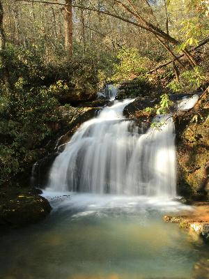
 Lower falls 12'
at
35.27936,-84.46646
Lower falls 12'
at
35.27936,-84.46646
| WGS84 | |
| 35.280710 | -84.466020 |
| 35° 16.843'N | 84° 27.961'W |
| 35° 16' 50.6"N | 84° 27' 57.7"W |
| 16S 730463E 3907118N | |
| convert to NAD27 | |
MAPS
Select one of the following maps to display this waypoint (WGS84).
GPS
Remarks:
Reference and photos: Brian Solomon
Three falls. GPS coordinates (map pin) are for upper falls
Upper falls 30'
Middle falls 20'
at
35.28029,-84.46563
Lower falls 12'
at
35.27936,-84.46646