Tennessee Landforms -- waterfalls| WGS84 |
| 35.440698 | -84.103743 |
| 35° 26.442'N | 84° 6.225'W |
| 35° 26' 26.5"N | 84° 6' 13.5"W |
| 16S 762900E 3925772N |
| convert to NAD27 |
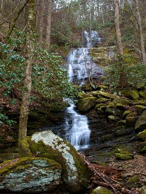
Gold Cabin Br Falls 90'
Waypoint: MOF046 35.440698,-84.103743
County: Monroe landforms of Monroe county
Locale: Cherokee National Forest
popup list of
nearby landforms (mileage, bearing)
MAPS
Select one of the following maps to display this waypoint (WGS84).
GPS
Remarks:
photo courtesy Michael Shannon:
Tennessee landforms
home
arches
waterfalls
rocks
peaks
balds
sinks
lakes
regions
county
GSMNP landforms (TN/NC)
BSF landforms (TN/KY)
or nearby
lookout towers
Chuck Sutherland's www.tnlandforms.com the future (2024)
 ©
Tom Dunigan
©
Tom Dunigan