Tennessee Landforms -- waterfalls| WGS84 |
| 35.367710 | -84.124460 |
| 35° 22.063'N | 84° 7.468'W |
| 35° 22' 3.8"N | 84° 7' 28.1"W |
| 16S 761255E 3917619N |
| convert to NAD27 |
Culvert Cascade 40'
Waypoint: MOF043 35.367710,-84.124460
County: Monroe landforms of Monroe county
Locale: Cherokee National Forest
popup list of
nearby landforms (mileage, bearing)
MAPS
Select one of the following maps to display this waypoint (WGS84).
GPS
Remarks:
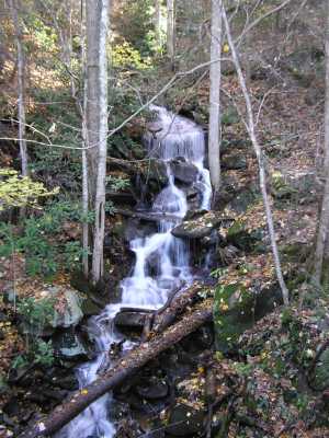 along Cherohala Parkway
Tennessee landforms
home
arches
waterfalls
rocks
peaks
balds
sinks
lakes
regions
county
GSMNP landforms (TN/NC)
BSF landforms (TN/KY)
or nearby
lookout towers
Chuck Sutherland's www.tnlandforms.com the future (2024)
 ©
Tom Dunigan
©
Tom Dunigan