Tennessee Landforms -- waterfalls| WGS84 |
| 35.423000 | -84.070400 |
| 35° 25.38'N | 84° 4.224'W |
| 35° 25' 22.8"N | 84° 4' 13.4"W |
| 16S 765986E 3923897N |
| convert to NAD27 |
Doublecamp Cascades(3)
Waypoint: MOF033 35.423000,-84.070400
County: Monroe landforms of Monroe county
Locale: Cherokee National Forest
popup list of
nearby landforms (mileage, bearing)
MAPS
Select one of the following maps to display this waypoint (WGS84).
GPS
Remarks:
Reference & photos: Robert Robbins
Series of cascades along Doublecamp creek. Waypoint is for
the upper cascade.
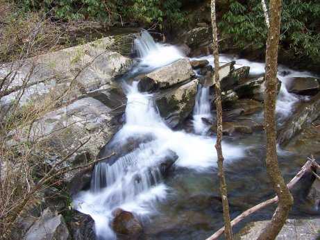 upper
upper
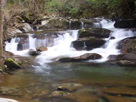 middle 35.42053 -84.07594
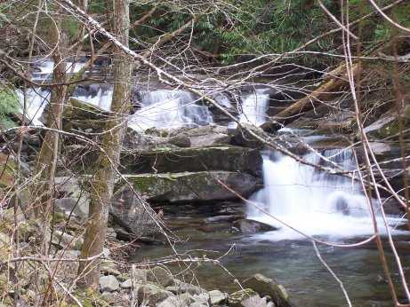 lower 35.42110 -84.07710
Tennessee landforms
home
arches
waterfalls
rocks
peaks
balds
sinks
lakes
regions
county
GSMNP landforms (TN/NC)
BSF landforms (TN/KY)
or nearby
lookout towers
Chuck Sutherland's www.tnlandforms.com the future (2024)
 ©
Tom Dunigan
©
Tom Dunigan