Tennessee Landforms -- waterfalls| WGS84 |
| 35.492700 | -84.008500 |
| 35° 29.562'N | 84° 0.51'W |
| 35° 29' 33.7"N | 84° 0' 30.6"W |
| 16S 771373E 3931799N |
| convert to NAD27 |
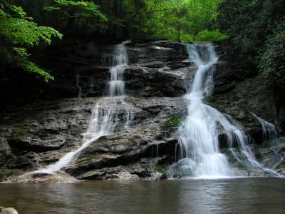
Tallassee Creek Falls 29'
Waypoint: MOF025 35.492700,-84.008500
County: Monroe landforms of Monroe county
Locale: Tapoco
popup list of
nearby landforms (mileage, bearing)
MAPS
Select one of the following maps to display this waypoint (WGS84).
GPS
Remarks:
Reference: pw
paddle the route of the old
Scona Lodge ferry to reach the manway
to this falls, more history
Tennessee landforms
home
arches
waterfalls
rocks
peaks
balds
sinks
lakes
regions
county
GSMNP landforms (TN/NC)
BSF landforms (TN/KY)
or nearby
lookout towers
Chuck Sutherland's www.tnlandforms.com the future (2024)
 ©
Tom Dunigan
©
Tom Dunigan