Tennessee Landforms -- waterfalls| WGS84 |
| 35.487400 | -83.978200 |
| 35° 29.244'N | 83° 58.692'W |
| 35° 29' 14.6"N | 83° 58' 41.5"W |
| 17S 229816E 3931175N |
| convert to NAD27 |
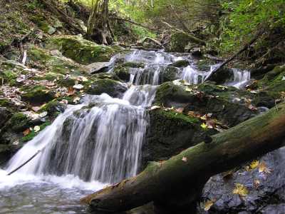
Goat Creek Cascade 9'
Waypoint: MOF024 35.487400,-83.978200
County: Monroe landforms of Monroe county
Locale: Tapoco
popup list of
nearby landforms (mileage, bearing)
MAPS
Select one of the following maps to display this waypoint (WGS84).
GPS
Remarks:
Tennessee landforms
home
arches
waterfalls
rocks
peaks
balds
sinks
lakes
regions
county
GSMNP landforms (TN/NC)
BSF landforms (TN/KY)
or nearby
lookout towers
Chuck Sutherland's www.tnlandforms.com the future (2024)
 ©
Tom Dunigan
©
Tom Dunigan